First trip of 2022 and it was an exciting one! Many miles of quickwater and class I-II rapids on this one-way trip (thanks uber), it is not a lazy float trip. Water level was great 240 cfs, 5.78 ft and cold 34F (!) on the Rochester Neck Road gauge. Air temps in low 40s, no wind. Scouting the water flow coming through the sluiceway of the old dam above the Rt 202 bridge, it looked steady but not raging, so I put in about 0.25 mile above this point so I could run it. There are three 1-ft drops (1st one soaked my seat 2 minutes into the trip) before you get to the calm pool above the sluiceway. After taking a moment, I ran the top of sluiceway successfully. But about 10 yards below in the narrow channel below, my boat starting pitching hard to the right. As I was about to go in, I bailed out. 1st swim of the year. The water was only about thigh deep but very quick here, only got soaked to my waist, but i had to let got of the kayak and watch it float under the Rt 202 bridge. A quick jog over the bridge and 50 yards downriver and I caught up to my capsized boat, drained it and caught my breath. The river goes right into a couple rocky rapids, with 2 huge boulders in the center, for another 1/4 mile before calming down a bit. In this section, 3 river-wide blowdowns required portage: the first on the left bank, the second a liftover, the third an easy landing to the right. This is before the "grand finale": a class II+ ledge/drop, following by a long 1/2 mile continuous rapids to Berrys Hill Bridge. This one I ran without swimming, it was very bouncy in spots but fun one. The final 30 minutes were flatwater to the steep take out on the left bank. There were many cool ice ledges and formations along the river and a few hawks and ducks out, but my eyes were mostly directly on the river in front of me during this trip.
Start: 254 Route 202, dirt pull-off across from Spring Drive (Pvt), Barrington, NH
End: Stillwater Circle, Rochester, NH
Trip Time: 2 hours 30 minutes;
Trip distance: 6 miles.

Put in is down the hill from 254 US-202


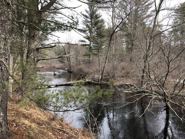
The view before dropping into the sluiceway (middle-right)


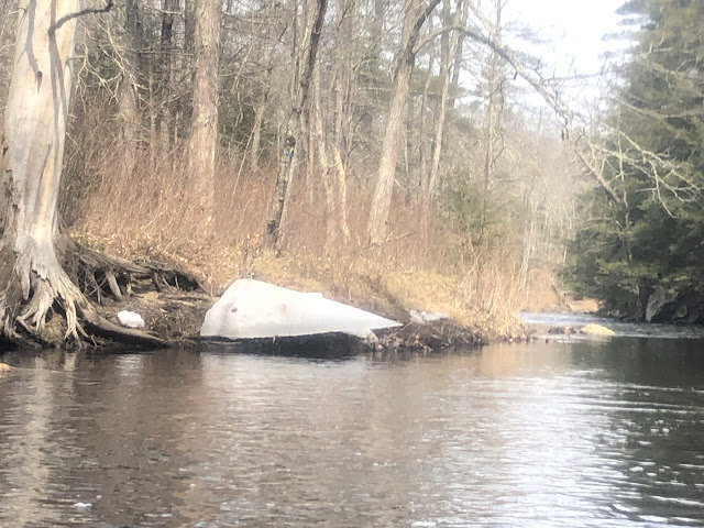
Caught up to my kayak here on the other side of the US-202 bridge


First portage left

Deer in the area


Nice ice

Old bridge abutments


Final portage right, looking back upstream


Steep takeout on the right


