Saturday, April 27, 2024

Assabet River - Maynard to West Concord

Nice spring trip down the Assabet River through downtown Maynard rapids into West Concord. Water levels were good, 261 cfs, 2.8 ft on the Maynard gauge. Scraped bottom a few times through Maynard but there was enough flow to get through without major issue. The biggest drop was under the very first bridge (Great Road / Rt 62), followed by a lot of Class I and quickwater until the Waltham St bridge Class II finale. A guy walking his dog across that bridge stopped to see how I'd do, I made it through with just a few scrapes. One portage on this trip, left around the Powder Mill Dam which was flowing fast and furious. The rest of the trip was quickwater to the very muddy Pine Street takeout.  Saw two fly fishermen in Acton. Many turtles were out sunning today.  

Start: Ben Smith Dam, Maynard, MA
End: Pine St Bridge, West Concord, MA
Trip Time: 1 hour 45 minutes 
Trip Distance: 5 miles


Put-in below the Ben Smith Dam

Great Road (Rt 62) bridge, I went right this time

Newly rebuilt (2023) Florida Road bridge 


Heading into downtown Maynard under the Assabet River Rail Trail then Main St bridges

Some outflows here and there but the river smelled fine on this day

Turtle time!!

looked like an abandoned kayak and a clear glass time machine above it

Powder Mill Dam in Acton, from above..

.. and below


A video to capture the flow and sound: 


Getting back onto the river below Powder Mill, had to drag/ferry to the right side of that abutment

Damon Mill looking stately in the sun

The mill race below Damon Mill

The muddy takeout at Pine Street.  River was sparkling 


Saturday, March 16, 2024

Piscataquog River, South Branch

First trip of 2024 and no swims!  This lively stretch on the South Branch Piscataquog River starts with a solid Class II drop just before the first (Central Sq) bridge in town, followed by another mile or so of continuous Class I rapids and riffles.  Medium-high water levels (4.95 ft and 468 cfs on the Goffstown gauge) provided the perfect amount of water to allow me to slide over and around the many boulders just under the surface - any higher and I would be pushing the limits of an open boat.  I did empty my kayak once at the bridge to the Hillsboro County Fair Grounds to re-gain some stability.  The rest of the trip was mix of easier riffles and couple more Class I rapids. No portages. Attempted a brief foray up the Middle Branch but the current was too strong at the confluence with the South Branch. An interesting egg was found on a mid-river boulder towards the end of the trip - early Easter?  A beautiful spring day -- 45F mostly sunny skies-- in southern New Hampshire.   

Start:  Whipple Free Library, 67 Mont Vernon Rd, New Boston, NH
End:  Howe Bridge, New Boston, NH
Trip Time:  1 hour 25 minutes  
Trip Distance:  5 miles


The put-in just beyond the Whipple Free Library

Put in the old mill race of a long gone dam

Trip starts with immediate riffles

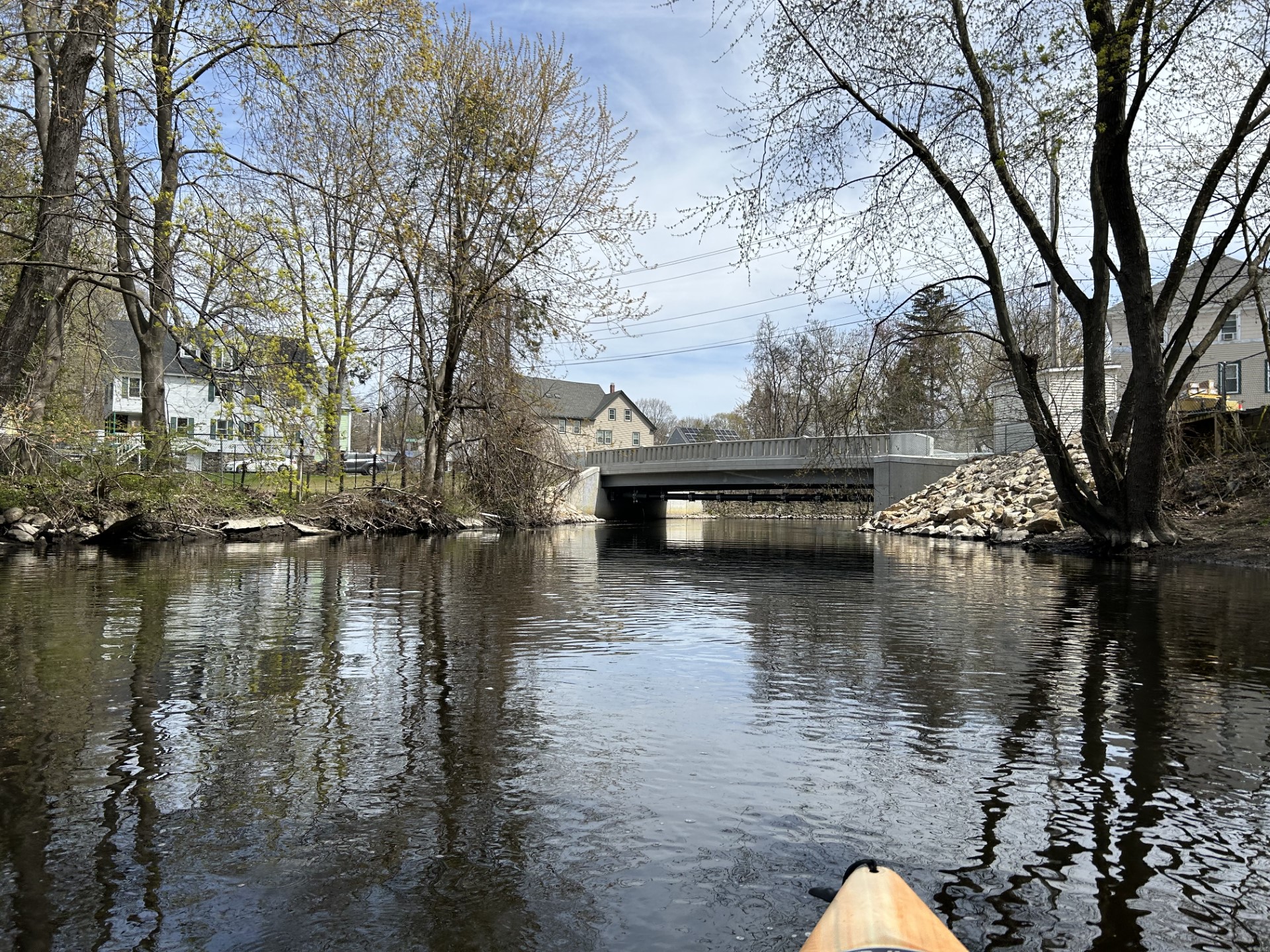
Approaching center of New Boston, first big drop below that white house

View of first rapid from the Central Sq bridge

Here's a video of that same section:


A second rapid awaits beyond the bridge

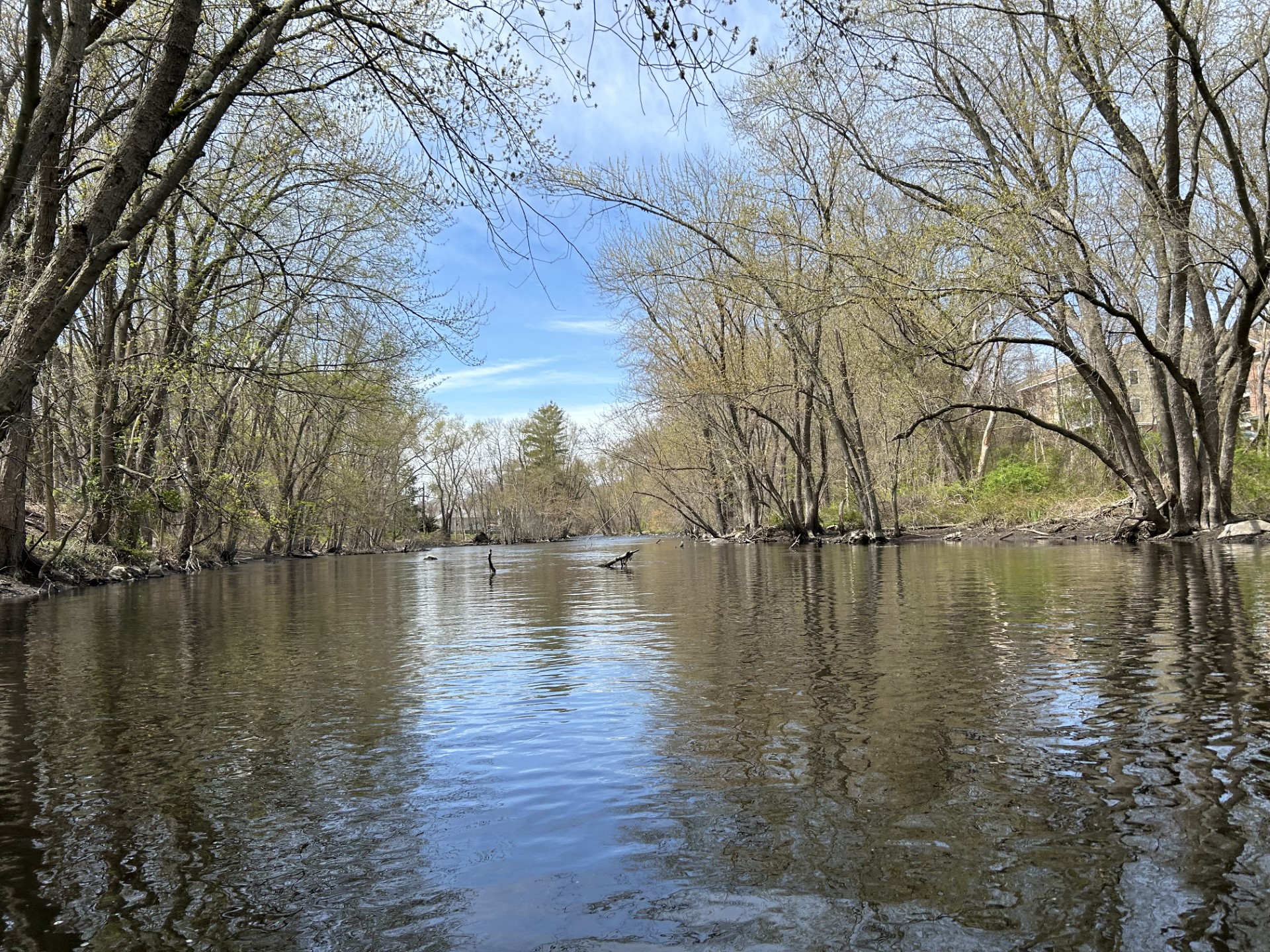
Looking back upstream after that exciting start

This section is typical of this river, many boulders but also paths around and sometime over them

Paused here to empty water out of boat

NH Route 13 often ran close to the river but is not heavily travelled, did not detract from the trip

Very cool artwork on the bridge abutments near Lang Station

The Middle Branch joins from the left beyond this bridge

Spotted this egg on a rock towards the end of the trip... did the Easter Bunny come to NH early?

The takeout at Howe Bridge

Stopped for a post trip sandwich at the Dodge Country Store in New Boston


Saturday, October 28, 2023

Souhegan River - Kaley Park to Seaverns/Fields Bridge

Gorgeous foliage trip down the Souhegan River on a warm, sunny 80F day. Leaves were falling all around and light wind made this a great trip. Uber'ed back to the start from the severely eroded takeout, parking for 2-3 cars across the street. The put in at Kaley Park has plenty of parking and a great staircase down to the water, though a little steep, I put in at a muddy patch 10 feet down river. The water level was medium-low, 3.96 ft, 130 cfs on the Milford gauge, which made the one rapid under Route 101 bridge easy to manage by going river right, maybe a class 1+ at this level. Scraped a couple times early but the rest of the trip was smooth paddling, no portages. Several golfers seen in the middle section. Passed a motionless blue heron at one point, usually they take off immediately.  

Start: Kaley Park, Milford, NH
End: Seaverns/Fields Bridge, Merrimack, NH
Trip time: 2 hours, 5 minutes  
Trip distance: 6 miles 


Nice stone marker (2012) at the Kaley Park put in

Whitewater kayaks could slide down the middle, I put in 10 feet to the right


There was light at the end of this tunnel but also some odors too - Milford Waste Water Facility

Old bridge abutments

High Route 101 bridge in the distance

Looking back upstream after running the rapid under Route 101, left side of picture (river right)

Leaves were falling here, several landed on my boat.

Amherst Country Club

The Hanging Gardens of Amherst

Pulley contraption... maybe collecting lost golf balls?

Nature is amazing...

Down in a hole 

Sandy river bottom

Boston Post Road bridge

Stopped for lunch

Some minnows nearby

River wide blow-down near the end of trip, was able to squeeze by on the right without getting out

Orange float near a river sucker


At the take-out